Roll Cloud Over France – What It Is and Why It Matters
Did you ever look up and see a huge, rolling tube of cloud stretching across the sky? That’s a roll cloud, a short‑lived but eye‑catching weather feature. Recently, locals in central France reported exactly that – a rare roll cloud that sparked curiosity among weather fans and scientists alike. In this article we’ll break down what a roll cloud is, how it forms, and why that fleeting sight is worth paying attention to.
What Makes a Roll Cloud Different?
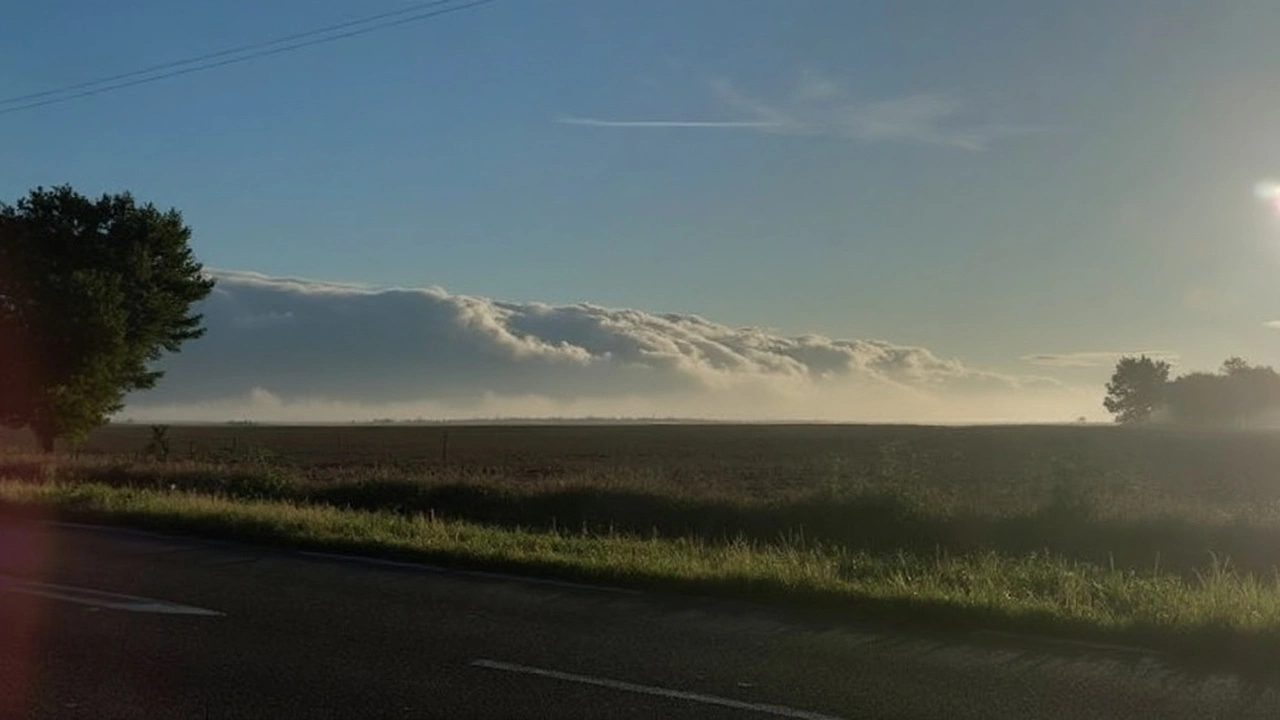
Roll clouds belong to the family of arcus clouds, but they don’t need a thunderstorm to appear. They form when a cool, dense air mass slides under a warm, moist layer. The boundary between the two creates a wave‑like motion, and the top of the wave rolls over the bottom, giving the cloud its distinct tube shape. Because the air motion is quick, the cloud usually lasts only a few minutes before it either spreads out or dissipates.
In France’s case, the roll cloud was spotted after a line of thunderstorms moved eastward. The cool air from the storm front met the warm air still lingering over the plains, setting the perfect stage for the phenomenon. While roll clouds can show up anywhere, they’re most common in places where sea breezes, mountain valleys, or storm outflows mix different air masses.
Why Should You Care About a Single Cloud?
Besides looking cool, roll clouds give scientists clues about atmospheric stability and wind patterns. When a roll cloud appears, it signals a strong wind shear – a rapid change in wind speed or direction with height. Knowing where and when this happens helps improve short‑term weather forecasts and can even aid pilots in avoiding turbulence.
For the everyday person, spotting a roll cloud can be a reminder of how dynamic our atmosphere is. It’s a live demo of the invisible forces that shape the weather we experience daily. And if you’re into photography or simply love a good sky show, keeping an eye on local weather alerts can help you catch the next one.
So the next time you hear about a “rare roll cloud” over a region, remember it’s not just a quirky cloud picture. It’s a brief window into the complex dance between cool and warm air, and a sign that the sky is constantly at work. Keep watching the horizon – you never know when nature will roll out something spectacular.
Kieran Lockhart, Jul, 2 2025
Rare Roll Cloud Spotted Over Central France Sparks Curiosity
A rarely seen roll cloud appeared over central France, mesmerizing locals and weather watchers. These tubular clouds form near thunderstorms when cool and warm moist air collide, creating a dramatic rolling shape in the sky. Details on the exact sighting remain scarce, but the spectacle highlights nature’s wild weather displays.
View More