Storm Erin's North Atlantic Journey Raises Weather Stakes for the UK
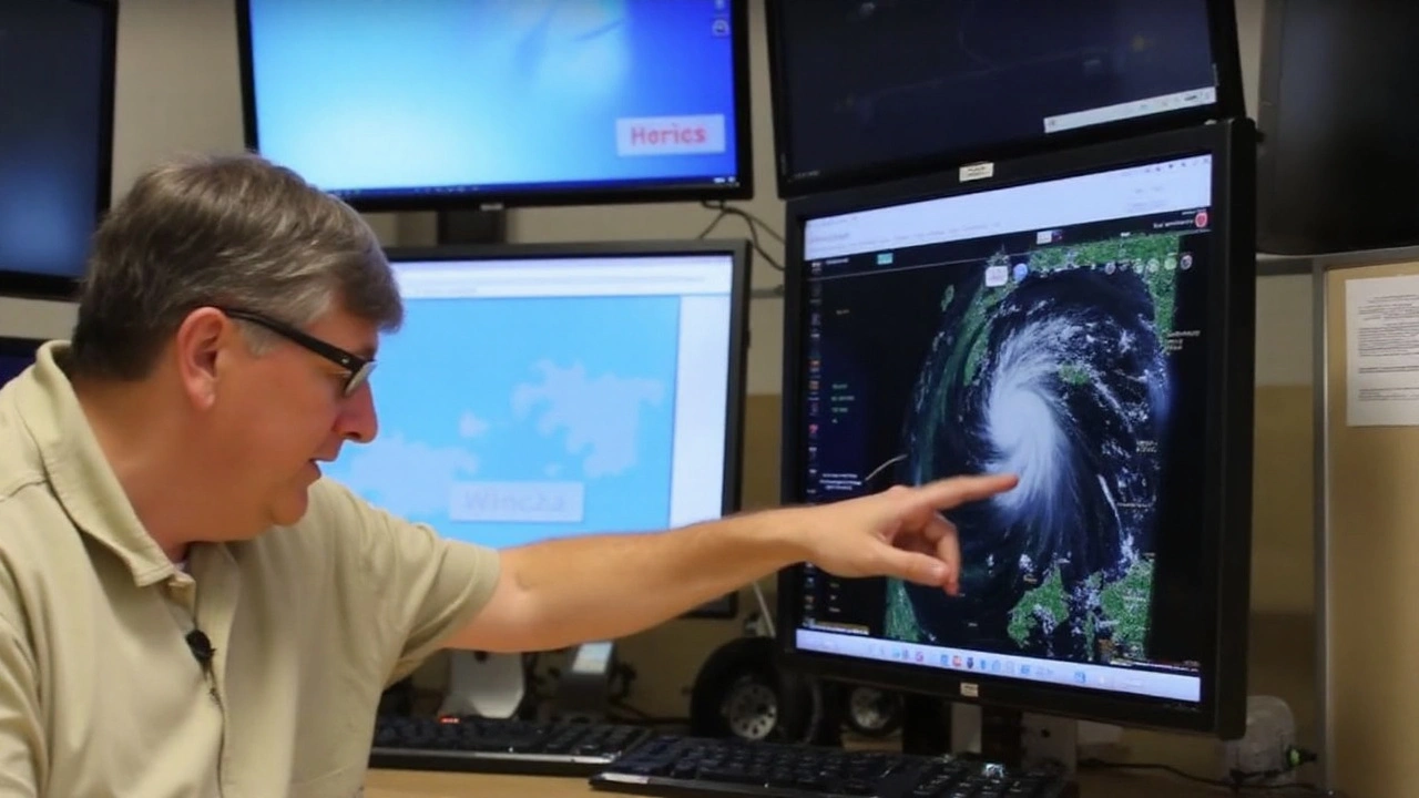
Forget barbecues in the sun. All eyes are now on Hurricane Erin, brewing over the Atlantic and heading the UK's way. While everyone’s been stretching out the seemingly endless summer, meteorologists are glued to their screens, tracking every twitch and turn of this tropical storm. Erin’s arrival could flip the script on the UK’s record-breaking heat and bring a big change in just a matter of days.
The Met Office hasn’t minced words. Hurricane Erin, currently moving northwards past the eastern coast of Canada, is gaining steam as it heads across the Atlantic. The UK’s meteorological agency says Erin is likely to sling a mass of low pressure across the ocean, a sharp shift from the persistent highs that have kept the country dry and sweltering for weeks. Think of it like opening a window on a stuffy summer evening – the breeze is coming, but it might not all be pleasant.
For now, the August bank holiday is expected to lay on more sunshine and warmth, especially in western regions. High-pressure systems have delivered blue skies and t-shirt temperatures, giving Brits a taste of Mediterranean living. But this settled spell is on borrowed time. By early next week, forecasters expect the approaching low pressure to chip away at this calm, throwing the forecast into uncertainty.
Forecast Chaos: Models Clash as Erin Approaches
Here’s where things get tricky. The Met Office’s top scientists, like meteorologist Alex Burkill, say confidence in the forecast drops the closer Erin gets. Forecasting storms isn’t straightforward – Erin’s path is like a curveball, with computer models split between soaking rain, wild winds, or maybe just a wobble in our current heatwave.
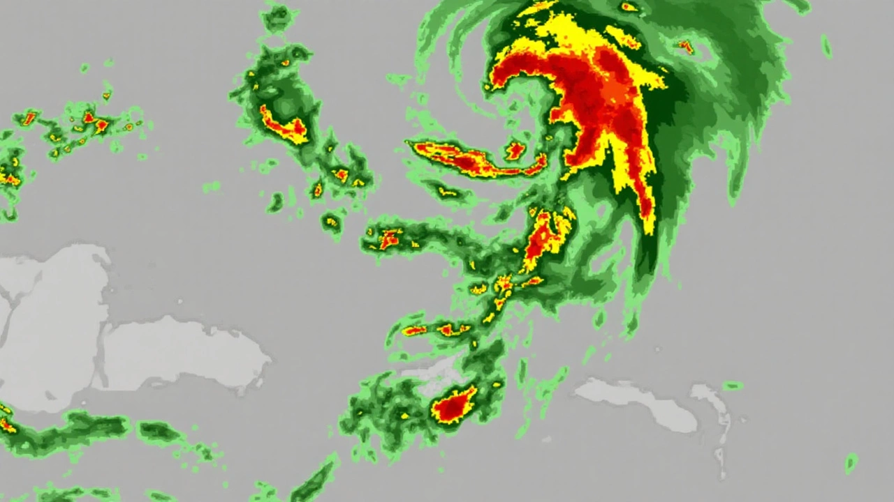
The European forecasting model, used to simulate thousands of possible outcomes, highlights just how up in the air things are. Some projections have a classic UK washout on the horizon – picture strong winds, bucketloads of rain, and weather reminiscent of the notorious Storm Floris. Other models keep the British summer dream alive, showing a ridge of high pressure stubbornly blocking storm clouds and letting the warmth stick around a little longer.
No matter which way Erin tilts, the days of dry lawns and endless heat are numbered. The Met Office expects temperatures to stay above average, but the real question is how much rain, wind, and cloud cover Erin will pull in with it. The storm’s dance with the jet stream is key – if the jet dips north, the UK might catch a break. If it swoops south, umbrellas could replace sun hats overnight.
Emily Carlisle, one of the Met Office’s climate scientists, has highlighted just how historic this summer is looking. So far, June and July haven’t just been warm – they’ve scorched previous records, with both months logging unusually high temperatures, even outside official heatwave periods. For anyone feeling like the heat has been relentless, the data backs up that hunch.
But as Erin gets closer, that consistent pattern of warm, dry days could unravel. By Monday, forecasters warn the weather will get more unpredictable. Most of the country will likely hang onto the warmth, but gusty winds and scattered showers will become more frequent – especially across northern and southwestern regions, where thundery downpours might barge in and spoil outdoor plans. Eastern UK could see more cloud and a hint of chill, a stark shift from the dazzling sunshine enjoyed during the holiday weekend.
Right now, the only certain thing is uncertainty. Models are still split, and each forecast update could swing expectations from sunny spells to a splash of autumn in August. Anyone hoping to keep cool in the shade may soon find themselves bracing for rain – but British weather is never boring, and next week could offer another wild chapter in the country’s most unpredictable summer yet.